")
In this article, you will learn:
1. How to structurally plan roof inspections with Mavic 3 Enterprise/ Thermal.
2. When thermography is useful (time window, rain breaks) and when pure RGB is sufficient.
3. What accuracy is possible with RTK/PPK/Cloud-PPK (GCPs as checkpoints).
4. Recommended camera settings (Shutter, ISO, 4:3/JPG, IronRed) + a brief test flight.
5. Mapping mission in DJI Pilot 2 (overlap, height, GSD, speed limits, Smart Oblique).
6. Safety: VLOS, no flying over people, check surroundings (parking lots, etc.).
7. Manual post-inspection (56× Zoom, SBS Split-Screen, Link-Zoom on M3T).
8. Processing in DJI Terra (RGB/Thermal separate, radiometry note, exports).
9. Third-party analysis tools (DroneDeploy, Loveland/Eagleview, Raptor Maps).
10. Training & Licenses: Inspection Training, A2/STS, product workshops.
1) Assess Object & Clarify Scope
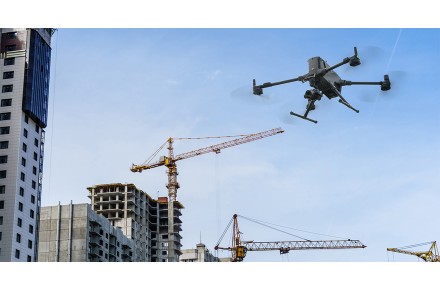
Check roof type, size, height, and surroundings (access roads, parking lots, obstacles). The M3E uses O3 Enterprise, omnidirectional avoidance, and APAS 5.0, but remains: adhere to VLOS and observe local rules for operation over people. Large roofs → Plan flight times & batteries (M3E ≈ 42 min per battery).

2) Define Goal & Sensor Technology
- Leak/Crack, HVAC, PV: Thermal + RGB often useful.
- Time for Thermography: usually shortly after sunset (no direct sunlight, but a warm roof). Often 2 flights: one RGB during the day, one thermal at dusk.
- After rain, do not fly immediately; as a rule, wait ≥24 h (up to one week).
3) Accuracy & References
Centimeter-accurate data without GCPs is possible with RTK; GCPs/Checkpoints are still recommended for validation. Alternatives: PPK/Cloud-PPK.
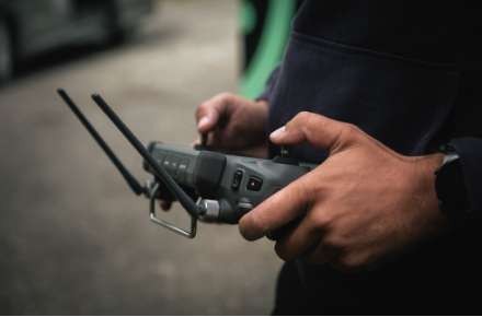
4) Camera/Sensor Settings
- Shutter during the day ≈ 1/1000 s or shorter; at night as short as possible.
- ISO: Auto during the day; manual at night to support shutter.
- Format: JPG, 4:3, mechanical shutter ON; Thermal: record all sensors.

- Thermal Palette: "IronRed" proven.
- Brief test flight in advance to avoid over-illumination.

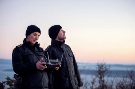
5) Flight Planning (DJI Pilot 2 → Mapping Mission)
- Overlap: RGB 70/80% (Front/Side); Thermal 80/80%.
- Height over the roof: Residential buildings 5–15 m, commercial 15–30 m. Use "Target Surface to Takeoff Point" for correct overlap when taking off from the ground.
- GSD (M3E, 4/3″): 7.5 m ≈ 0.2 cm/px · 15 m ≈ 0.4 · 22.5 m ≈ 0.6 · 30 m ≈ 0.8.
- GSD (M3T): 7.5 m ≈ 0.26 cm/px RGB / 1.0 therm.; 15 m ≈ 0.53 / 1.98; 22.5 m ≈ 0.78 / 2.97; 30 m ≈ 1.05 / 3.96.
- Smart Oblique: great for 3D RGB; not for thermal PV measurements.
- Speed: M3E uncritical thanks to 0.7-s interval; maintain Thermal <4.4 m/s.
- Direction: for thermal PV, fly parallel to module rows.

6) Data Collection & Safety
Maintain VLOS, monitor FPV & path, no flying over people. Set mission end (RTH/hover) appropriately.
7) Manual Post-Inspection
Capture details using the 56× Hybrid Zoom. On M3T: Activate Side-by-Side (Zoom+Thermal), use Link-Zoom so both sensors zoom synchronously.


8) Processing (DJI Terra)
- Import photos (process RGB and Thermal separately).
- Select outputs (2D map, 3D model; TIFF/OBJ, etc.), set coordinate system (e.g., with NTRIP).
- Start aerotriangulation; optionally crop reconstruction boundaries.
- Optional: Import GCPs, select correct EPSG; then execute 2D/3D reconstruction.
Note: Terra does not guarantee radiometrically composed thermal output – keep raw thermal images for analysis.

9) Visualization & Analysis
Many findings (cracks/leaks/hotspots) are checked on the 2D ortho; 3D helps for context. Third-party providers:
- DroneDeploy (roof report, thermal histogram, time-series comparison).
- Loveland Innovations – IMGING & Eagleview (automatic damage detection, reports).
- Raptor Maps (PV thermal analysis, benchmark from GW scale).

DJI Thermal Analysis Tool supports raw images; converters (e.g., RJPG) available for FLIR workflows.

10) Training & Licenses (DJI Academy | Pro Fly Center)
Inspection training (with DJI certificate) · A2 (from €99) · STS (from €499) · Product training (from €299) · Workshops (from €799) · BOS training (from €399).
Questions? info@proflycenter.com · Online Shop: DJI Drones

Conclusion
A clear workflow from goal definition → mapping → thermal/RGB → validated processing → analysis delivers reliable results with minimal risk – faster, safer, and cheaper than manually accessing complex roofs.
Are you interested in this topic? Check it out!