Problem: Drones are "invisible" at low altitudes → BVLOS is restricted.
Solution: Droniq UTM + HOD4track (LTE) makes UAS visible (ADS-B/FLARM, DFS data).
Benefit: Complete air situation picture, more safety, easier clearances.

However, as with any young technology, there are naturally challenges that concern potential users. For drones, this primarily affects one question:
How do you make drones visible to users of the same airspace?
Due to the low altitude at which drones mostly operate, they are not detected by air traffic radar and are thus invisible to other air traffic participants. The drone pilot must always keep the aircraft in sight. Consequently, this means that he must fly the drone only VLOS, i.e., within his visual line of sight. BVLOS flights, where the drone flies beyond the pilot's visual line of sight, are therefore not possible for him.
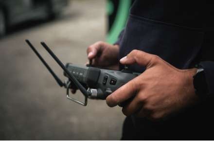
A solution for this, which is increasingly being used by BOS forces and companies, comes from the company Droniq in Frankfurt. The subsidiary of Deutsche Flugsicherung (German Air Navigation Service Provider) and Deutsche Telekom provides its customers with a traffic management system for drones (UTM). Via this web application, the pilot receives a live air situation picture that shows him his surroundings and the manned and unmanned air traffic taking place within it. Air traffic control supplies the information on manned air traffic. Meanwhile, the matchbox-sized LTE transponder, the so-called HOD4Track, as well as separate ground sensor technology, ensure that unmanned air traffic is also displayed to the drone pilot.


The HOD4Track is attached to the drone and receives traffic information from the unmanned air traffic. This information, as well as the position of the LTE transponder itself, is also transmitted to the traffic management system. The drone pilot thus receives a complete air situation display and sees exactly what is happening around him. In addition, the LTE transponder also sends its information via FLARM to other traffic participants and receives ADS-B. This makes the drone visible to them as well.

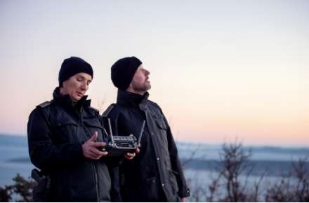
We were on-site with Droniq and the Johanniter / Forest fire emergency exercise with regional BOS forces
APPLICATION PURPOSE:
The micro-LTE transponder HOD4track (HOD: Hook-on-Device) serves to transmit its own position data for UAS and other aircraft (e.g., helicopters) and thus makes every aircraft visible.
HOW THE UTM WORKS:
1. DRONE WITH HOOK-ON-DEVICE: The LTE module attached to the drone with an integrated SIM card sends its position data as well as optional payload data (videos, photos, sensor data) via the Telekom mobile network. The drone also receives control commands (Command & Control) through this.
2. MOBILE NETWORK: The mobile network is already widely available and serves as the basic infrastructure.
3. PAYLOAD DATA: The payload data is made available to the drone controller or the end-user via the cloud.
4. UTM: WEB CLIENT & APP: Via their UTM access, the drone controller keeps an eye on the airspace in the close vicinity and is informed about all relevant flight activities. Flight preparation and follow-up also take place via the UTM, as does the entire user management.
5. DRONE DETECTION SYSTEMS: All common drone detection systems can be connected to the UTM via an interface, and thus, by comparing data, it can be determined which drones are potentially dangerous.
6. NON-COOPERATIVE DRONES: Drones flying without an LTE module are initially not visible to the UTM. However, with the sensor technology of drone detection systems, these drones can also be located and integrated into the UTM as a position source.
7. GROUND SENSOR TECHNOLOGY: The system for ground sensor technology receives position data of VFR traffic in the close vicinity, such as FLARM and ADS-B, and sends this position data to the UTM via mobile radio.
8. POSITION DATA OF MANNED AIR TRAFFIC: The transponder data of commercial aircraft (IFR) is received and processed via the DFS radar infrastructure.
9. INTERFACE TO DFS: Data of the manned air traffic relevant to drones also flows into the UTM via an interface.
10. UTM CLOUD: Droniq's UTM offers all services for safe and efficient drone operation.


Are you interested in this topic? Check it out!