In this article, you will learn:
1. What defines the Mavic 3 Enterprise series (4/3 CMOS, mechanical shutter, 56× hybrid zoom, RTK, 45 min flight time).
2. What the Mavic 3E is optimized for (mapping/surveying, 0.7-s intervals, GCP-free workflows).
3. What the Mavic 3T is optimized for (Thermal 640×512, point/area measurement, isotherms, night operations).
4. How DJI O3 Enterprise keeps image transmission (1080p/30) and range (up to 15 km FCC) stable.
5. Which safety features are onboard (ADS-B AirSense, APAS 5.0 with 360° fisheye sensor technology).
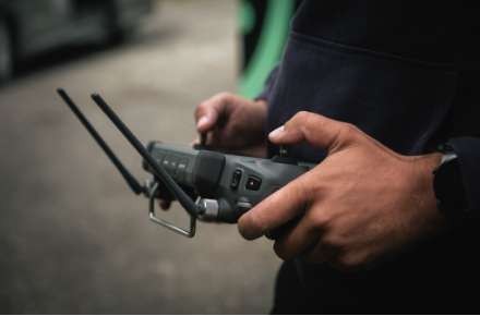
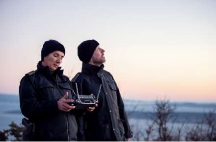
6. Which Pro accessories fit (RC Pro Enterprise 1000 nit, RTK module, D-RTK 2, loudspeaker with TTS/loops).
7. Which software ecosystem belongs to it (Pilot 2, FlightHub 2, Terra, Thermal Analysis Tool 3.0).
Core Idea: Compact, Precise, Mission-Ready
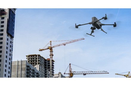
The DJI Mavic 3 Enterprise sets standards as a small industrial drone: 4/3 CMOS main camera, mechanical shutter, 56× hybrid zoom, RTK support, and – with the T-model – a powerful thermal imaging camera. Typical domains: terrain mapping, inspection, search & rescue.
DJI Mavic 3E – Surveying Speed
20 MP wide-angle with 4/3 CMOS (3.3 µm pixels) and mechanical shutter for 0.7-s interval shots. Highly efficient mapping missions often without GCPs thanks to the RTK module. The tele camera (162 mm) delivers 12 MP and up to 56× hybrid zoom.

DJI Mavic 3T – Making the Invisible Visible
In addition to the tele camera, the 3T has a 48 MP 1/2″ camera and a Thermal Unit 640×512 (≈40 mm). Supports point and area temperature measurement, palettes & isotherms, alarm limits, and up to 28× digital zoom (Thermal/Zoom). Ideal for firefighting, SAR, night operations, inspection.

Range & Link
DJI O3 Enterprise Transmission streams stably in 1080p/30; maximum control range up to 15 km (FCC) (note regional limits). Flight time up to 45 minutes.
Safe Flying
DJI AirSense (ADS-B) warns of manned traffic. APAS 5.0 uses six omnidirectional fisheye sensors for obstacle detection without blind spots – more orientation and safety.

Tools for Professionals
- RC Pro Enterprise: 1000-nit display, integrated microphone.
- RTK Module: Centimeter accuracy via RTK networks, Custom-NTRIP, or D-RTK 2.
- D-RTK 2 Mobile Station: high-precision GNSS receiver for real-time corrections.
- Loudspeaker: Text-to-Speech, audio storage, loop – e.g., for SAR announcements.

Software Ecosystem
- DJI Pilot 2: modernized flight interface, sensor/mission control.
- DJI FlightHub 2: Cloud fleet management, route planning, mission coordination.
- DJI Terra: mission planning, 2D/3D reconstruction for maps/models.
- Thermal Analysis Tool 3.0: evaluation/annotation of 3T thermal data.

Availability & Training
At the Pro Fly Center with a package of free/discounted training courses (A2, BOS, Photogrammetry, Inspection).
Are you interested in this topic? Check it out!